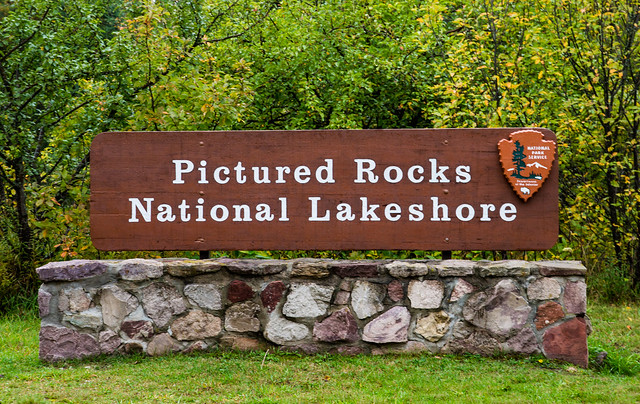
Pictured Rocks National Lakeshore
Pictured Rocks National Lakeshore is a stunning natural area located in the state of Michigan, United States. Situated along the southern shore of Lake Superior, this national lakeshore spans approximately 42 miles from Munising to Grand Marais. The park covers a total area of 73,236 acres, providing visitors with abundant opportunities to explore its picturesque landscapes.
The historical background of Pictured Rocks National Lakeshore traces back to ancient times when Native American tribes inhabited the area. These tribes, such as the Ojibwa and Huron, considered the region sacred and used it for fishing, hunting, and gathering. Later, European explorers and fur traders arrived, and the area became a significant trade route. The establishment of the national lakeshore occurred in 1966, highlighting the importance of preserving the unique and scenic features present in the area.
One of the main attractions at Pictured Rocks National Lakeshore is its impressive sandstone cliffs. These cliffs, standing up to 120 feet tall, showcase an array of vibrant colors, ranging from reds and pinks to whites and blues. The striking patterns and formations have resulted from thousands of years of erosion by wind, water, and ice. Famous landmarks along the cliffs include Lover's Leap, Miners Castle, Indian Head, and Chapel Rock.
Visitors to Pictured Rocks can indulge in a variety of activities. Hiking trails wind their way through the park, offering picturesque views and glimpses of waterfalls, beaches, and hidden coves. Camping options are available, allowing visitors to spend the night under the stars amidst the beautiful natural surroundings. Boat cruises along Lake Superior provide an opportunity to witness the stunning cliffs from a different perspective, while kayaking and canoeing offer a more active way to explore the park's rugged shoreline.
Not far from Pictured Rocks National Lakeshore, there are other attractions that visitors can explore. The neighboring Hiawatha National Forest offers additional opportunities for outdoor activities, including fishing, hunting, and birdwatching. The town of Munising, located at the western end of the lakeshore, serves as a base for visitors and provides amenities such as lodging, dining, and shopping. The nearby Grand Island National Recreation Area is also worth a visit, offering opportunities for camping, hiking, and biking.
Overall, Pictured Rocks National Lakeshore in Michigan presents a remarkable display of natural beauty and serves as a testament to the area's historical significance. Visitors can immerse themselves in the stunning landscapes, engage in various outdoor activities, and explore the nearby attractions, ensuring an unforgettable experience in this pristine corner of the Great Lakes region.
Location
Pictured Rocks National Lakeshore is nestled within the state of Michigan, specifically on the southern shore of Lake Superior. It spans over 40 miles of pristine coastline, stretching from Munising to Grand Marais. This remarkable natural wonder lies within the Upper Peninsula region, offering breathtaking views of the Great Lakes' sparkling turquoise waters and towering sandstone cliffs that reach up to 200 feet high. The park's location showcases the enchanting beauty of the northernmost part of the state, surrounded by lush forests and serene inland lakes. Pictured Rocks National Lakeshore is a true gem and a testament to the diverse and awe-inspiring landscapes that Michigan has to offer.
Address & Contact
1505 Sand Point RoadMunising, MI 49862Driving DirectionsPhone: 906-387-3700Web: Link
Weather & Seasonality
The best time to visit Pictured Rocks National Lakeshore is during the months of May, June, and September. These months provide pleasant weather for outdoor activities with average maximum temperatures ranging from the upper 50s to mid-70s Fahrenheit. Additionally, visitor counts during these months are relatively moderate compared to the peak months of July and August, allowing you to avoid large crowds. These months also offer average monthly precipitation ranging from 2.8 to 3.8 inches, which is generally manageable for outdoor exploration.
Things to do and learn in Pictured Rocks National Lakeshore
Activities
Some of the activities you can do in Pictured Rocks National Lakeshore are: Astronomy Stargazing Food Picnicking Guided Tours Hands-On Junior Ranger Program Wildlife Watching Birdwatching Museum Exhibits Shopping Bookstore and Park Store Biking Road Biking Camping Backcountry Camping Car or Front Country Camping Climbing Hiking Front-Country Hiking Boating Motorized Boating Canoe or Kayak Camping Fishing Backcountry Hiking Hunting and Gathering Hunting Paddling Canoeing Kayaking Skiing Cross-Country Skiing Snowmobiling Auto and ATV Scenic Driving Snow Play Snowshoeing Swimming Boat Tour Group Camping RV Camping Freshwater Fishing Fly Fishing Volunteer Vacation Stand Up Paddleboarding SCUBA Diving Freshwater Swimming Jet Skiing Ice Climbing
Topics
Learn about these topics at Pictured Rocks National Lakeshore: Animals Birds Geology Groundwater Night Sky Industry Logging and Timber Cutting Fish Tortoises and Turtles River and Riparian Rock Landscapes and Features Arches Trails Unique Species Wilderness Military Wolves Aurora Borealis Climate Change Forests and Woodlands Glaciers Lakes Natural Sounds Astronomy Scenic Views Waterfalls Wetlands Deciduous Forests Marshes Swamps Coniferous Forests Endangered Coasts, Islands and Atolls Dunes Maritime Ships and Shipwrecks US Coast Guard Lighthouses
Amenities
Visitor Centers
Munising Falls Visitor Center
See below for hours, directions, and contact information.
Passport Stamp locations
The following locations have passport stamps for your "Passport to Your National Parks" booklet: Munising Falls Visitor Center.
Campsites within or near Pictured Rocks National Lakeshore
Au Sable East Group Backpacking Site
Au Sable Point East Group Campground is 0.2 miles west of the Au Sable Light Station and inland from the North Country Trail. The group campsite is surrounded by a coniferous forest. There is access to Lake Superior with a view of the Grand Sable Dunes. One shared fire ring and pit toilet. Water source is Lake Superior. Lake Superior access for kayakers.
Fees (US$): 5.00 (Camping Fee - Per Person, Per Night), 15.00 ((Plus Reservation Fee))
Total Campsites: 1
Toilets: NULL
Showers: NULL
Potable Water: NULL
Au Sable East Individual Backpacking Sites
Au Sable Point East Campground is next to the Au Sable Point East Group Campground. Due to the dense forest, you are unable to see the neighboring campground. The six campsites are scattered throughout the trees. Shared fire ring and pit toilet. Water source is Lake Superior. Lake Superior access for kayakers
Fees (US$): 5.00 (Camping Fee - Per Person, Per Night), 15.00 ((Plus Reservation Fee))
Total Campsites: 6
Toilets: Vault Toilets - seasonal
Showers: None
Potable Water: Water
Beaver Creek Individual Backpacking Sites
Beaver Creek Campground is on the bluff above Lake Superior and Beaver Creek in the Beaver Basin Wilderness. The six campsites are dispersed throughout the sandy grounds, shaded by pine trees. There is one communal fire ring with a view of Lake Superior. Shared pit toilet. Water source is Lake Superior and Beaver Creek. Lake Superior access for kayakers.
Fees (US$): 5.00 (Camping Fee - Per Person, Per Night), 15.00 ((Plus Reservation Fee))
Total Campsites: 6
Toilets: Vault Toilets - seasonal
Showers: None
Potable Water: Water
Benchmark Individual Backpacking Sites
Benchmark Campground is on a sandy bluff above Lake Superior. The six campsites are sandy and open. There are social trails that lead down to Lake Superior, but it is a steep climb back to your campsite. When hiking from the west, walk through Twelvemile Beach Campground to the trailhead and day use area to connect back to the North Country Trail. Two shared fire rings and a pit toilet. Water source is Lake Superior. Lake Superior access for kayakers.
Fees (US$): 5.00 (Camping Fee - Per Person, Per Night), 15.00 ((Plus Reservation Fee))
Total Campsites: 6
Toilets: Vault Toilets - seasonal
Showers: None
Potable Water: Water
Chapel Individual Backpacking Sites
Chapel Beach Campground sits on the sand bluff above Chapel Beach and Lake Superior. Chapel Beach is a popular day use area, so the six sites here offer less isolation than other backcountry campgrounds. Shared pit toilet. Water source is Chapel Creek and Lake Superior. Lake Superior access for kayakers. NO CAMPFIRES.
Fees (US$): 5.00 (Camping Fee - Per Person, Per Night), 15.00 ((Plus Reservation Fee))
Total Campsites: 6
Toilets: Vault Toilets - seasonal
Showers: None
Potable Water: Water
Cliffs Group Backpacking Site
Cliffs Group Campground is one mile east of Cliffs Campground. It lies high above Lake Superior and inland from the North Country Trail. You will not be able to see the lake from the campground in the summer. There are spots along the North Country Trail near the campground to get a glimpse of Grand Island and Lake Superior. One shared fired ring and pit toilet. Visitors must bring water. NO ACCESS TO WATER.
Fees (US$): 5.00 (Camping Fee - Per Person, Per Night), 15.00 ((Plus Reservation Fee))
Total Campsites: 1
Toilets: Vault Toilets - seasonal
Showers: None
Potable Water: No water
Cliffs Individual Backpacking Sites
Cliffs Campground rests high above Lake Superior inland from the North Country Trail. The three campsites are in an open area with little cover between sites. During the summer months when the foliage is at its peak, you cannot see Lake Superior from the campground. There are places along the trail to sneak a peek of Grand Island and the lake. One shared fired ring and pit toilet. Visitors must bring water. NO ACCESS TO WATER.
Fees (US$): 5.00 (Camping Fee - Per Person, Per Night), 15.00 ((Plus Reservation Fee))
Total Campsites: 3
Toilets: Vault Toilets - seasonal
Showers: None
Potable Water: No water
Coves Group Backpacking Site
Coves Group Campground is three miles east of Chapel Beach. You are still up on the cliff line, but have started your descent towards Twelvemile Beach. Hike east on the North Country Trail about a quarter mile to find a trail to a small cove and beach on Lake Superior; this is where you have access to water. One shared fire ring and pit toilet. No access for kayakers due to 1/4 mile portage.
Fees (US$): 5.00 (Camping Fee - Per Person, Per Night), 15.00 ((Plus Reservation Fee))
Total Campsites: 1
Toilets: Vault Toilets - seasonal
Showers: None
Potable Water: Water
Coves Individual Backpacking Sites
Coves Campground is inland from the North Country Trail, hidden behind the pine trees and ferns. There are two entry points to the campground. The campground trail leads through the forest where you will find five campsites and two designated metal communal fire rings. There is Lake Superior and beach access from the bluff along the North Country Trail. Water source is Lake Superior. Shared pit toilet. Lake Superior access for kayakers.
Fees (US$): 5.00 (Camping Fee - Per Person, Per Night), 15.00 ((Plus Reservation Fee))
Total Campsites: 5
Toilets: Vault Toilets - seasonal
Showers: None
Potable Water: Water
Grand Sable Lake Boat-In Site
Grand Sable Lake on the park's east end has one boat-in backcountry campsite. Campers must provide their own boat and launch at the Grand Sable Lake boat launch. The campground is 1/2 mile south of the boat launch along the east shore. One fire ring and pit toilet. Water source is Grand Sable Lake. Ideal for kayakers and canoers.
Fees (US$): 5.00 (Camping Fee - Per Person, Per Night), 15.00 ((Plus Reservation Fee))
Total Campsites: 1
Toilets: Vault Toilets - seasonal
Showers: None
Potable Water: Water
Hurricane River Campground
There are two loops: 11 campsites in the lower loop and ten in the upper loop. Both loops include one disabled- accessible campsite. Several campsites are designated as generator-free. Because the turning radius and some parking site lengths are limited within this campground, we recommend single vehicles no more than 36 feet and vehicle/trailer combined length no more than 42 feet use this campground. The campground is open by reservation only, mid-May through mid-October. Leashed pets allowed.
Fees (US$): 25.00 (Camping Fee - mid May to mid October)
Total Campsites: 21
Toilets: Vault Toilets - seasonal
Showers: None
Potable Water: Yes - seasonal
Little Beaver Lake Campground
Little Beaver Lake Campground has 8 campsites on a beautiful inland lake. One campsite is disabled- accessible. Single unit vehicles in excess of 36 feet and vehicle/trailer combined units in excess of 42 feet are prohibited at Little Beaver because of the small campsites and the narrow, twisting, hilly access road. Pets are NOT allowed at this campground. The campground is open by reservation only, mid-May through mid-October. Closed the rest of the year.
Fees (US$): 25.00 (Camping Fee - mid May to mid October)
Total Campsites: 8
Toilets: Vault Toilets - seasonal
Showers: None
Potable Water: Yes - seasonal
Lowney Creek Group Backpacking Site
Lowney Creek Group Campground is one mile from Little Beaver Lake Campground and 2.5 miles inland from Lake Superior. Lowney Creek Group Campground is in the Beaver Basin Wilderness. The trail to the campground follows the Beaver Lake shoreline. Water source is Beaver Lake. One shared fire ring and NO toilet. Water access to this campground is via Little Beaver Lake, then Beaver Lake.
Fees (US$): 5.00 (Camping Fee - Per Person, Per Night), 15.00 ((Plus Reservation Fee))
Total Campsites: 1
Toilets: NULL
Showers: NULL
Potable Water: NULL
Lowney Creek Individual Backpacking Sites
Lowney Creek Campground is 1.5 miles from Little Beaver Lake Campground and three miles inland from Lake Superior. Lowney Creek Campground is in the Beaver Basin Wilderness. The four sites are in a meadow scattered with big trees on the south shore of Beaver Lake. Lowney Creek is on the east side of the campground. One shared fire ring and NO toilet. Water source is Lowney Creek and Beaver Lake. Water access to the campground is via Little Beaver Lake, then Beaver Lake.
Fees (US$): 5.00 (Camping Fee - Per Person, Per Night), 15.00 ((Plus Reservation Fee))
Total Campsites: 4
Toilets: Vault Toilets - seasonal
Showers: None
Potable Water: Water
Masse Homestead Group Backpacking Site
Masse Homestead Group Campground is to the west of the regular campground. It too is at the base of the dunes in a thick forest canopy. One shared fire ring and NO toilet. Visitors must bring water. NO ACCESS TO WATER.
Fees (US$): 5.00 (Camping Fee - Per Person, Per Night), 15.00 ((Plus Reservation Fee))
Total Campsites: 1
Toilets: Vault Toilets - year round
Showers: None
Potable Water: No water
Masse Homestead Individual Backpacking Sites
Masse Homestead Campground is at the base of the dunes (south side) and sheltered due to the thick forest canopy. The three campsites are close together at the base of the dunes. One shared fire ring and NO toilet. Visitors must bring water. NO ACCESS TO WATER.
Fees (US$): 5.00 (Camping Fee - Per Person, Per Night), 15.00 ((Plus Reservation Fee))
Total Campsites: 3
Toilets: Vault Toilets - seasonal
Showers: None
Potable Water: No water
Mosquito River Group Backpacking Site
Mosquito River Group Campground is on the west side of Mosquito River just a few steps away from the North Country Trail. There is a bluff near the campsite overlooking Lake Superior, which provides easy access to Mosquito Beach and the river. Shared pit toilet. Water source is Mosquito River and Lake Superior. Lake Superior access for kayakers. NO CAMPFIRES.
Fees (US$): 5.00 (Camping Fee - Per Person, Per Night), 15.00 ((Plus Reservation Fee))
Total Campsites: 1
Toilets: Vault Toilets - seasonal
Showers: None
Potable Water: Water
Mosquito River Individual Backpacking Sites
Mosquito River Campground is on the east side of the Mosquito River high above the lake. Depending upon which of the five campsites you choose, you can hear the waves crashing on the cliffs or the Mosquito River flowing into Lake Superior. Shared pit toilet. Water source is Mosquito River and Lake Superior. Lake Superior access for kayakers. NO CAMPFIRES.
Fees (US$): 5.00 (Camping Fee - Per Person, Per Night), 15.00 ((Plus Reservation Fee))
Total Campsites: 5
Toilets: Vault Toilets - seasonal
Showers: None
Potable Water: Water
Pine Bluff Individual Backpacking Sites
Pine Bluff sites are on a sandy bluff above Lake Superior just off the North Country Trail. The five campsites are on a sandy open area covered in ferns with pine trees scattered throughout the area. Access the beach and Lake Superior from a trail on the bluff at the entrance to the campground.
Fees (US$): 5.00 (Camping Fee - Per Person, Per Night), 15.00 ((Plus Reservation Fee))
Total Campsites: 5
Toilets: Vault Toilets - seasonal
Showers: None
Potable Water: Water
Potato Patch Individual Backpacking Sites
Potato Patch Campground is inland from the North Country Trail. Follow a trail through an open field with the sounds of a waterfall at your back. The fire ring is at the entrance to the campground. Follow the trail to the right to reach each of the three sites. Within the campground, the view of Grand Island and Lake Superior is blocked during the summer by the birch and maple leaves. One shared fire ring and pit toilet. Visitors must bring water. NO ACCESS TO WATER.
Fees (US$): 5.00 (Camping Fee - Per Person, Per Night), 15.00 ((Plus Reservation Fee))
Total Campsites: 3
Toilets: Vault Toilets - seasonal
Showers: None
Potable Water: No water
Sevenmile Creek Group Backpacking Site
Sevenmile Creek Group Campground is on the east side of Sevenmile Creek. The North Country Trail guides you over a foot bridge, through the woods and opens up into the group site. It is a wide-open area with access to Lake Superior. One shared fire ring and NO toilet. Water source is Sevenmile Creek and Lake Superior. Lake Superior access for kayakers.
Fees (US$): 5.00 (Camping Fee - Per Person, Per Night), 15.00 ((Plus Reservation Fee))
Total Campsites: 1
Toilets: NULL
Showers: NULL
Potable Water: NULL
Sevenmile Creek Individual Backpacking Sites
Sevenmile Creek Campground is on the west bank of Sevenmile Creek. The North Country Trail wanders through the campground and past the communal fire ring. The sites are separated by trees, which offer a bit of privacy. Three of the five sites are along the creek. Lake Superior access is on the east side of the creek through the Sevenmile Creek Group Campground. NO toilet. Water source is Sevenmile Creek and Lake Superior. Lake Superior access for kayakers.
Fees (US$): 5.00 (Camping Fee - Per Person, Per Night), 15.00 ((Plus Reservation Fee))
Total Campsites: 5
Toilets: Vault Toilets - seasonal
Showers: None
Potable Water: Water
Trappers Lake Group Backpacking Site
Trappers Lake Group Campground is a little over a mile inland from the North Country Trail and 0.2 miles east of Trappers Lake Campground. It is on the north shore of Trappers Lake in the Beaver Basin Wilderness. One shared fire ring and pit toilet. Water source is Trappers Lake. This is a hike-in campground only; kayakers cannot access this campground.
Fees (US$): 5.00 (Camping Fee - Per Person, Per Night), 15.00 ((Plus Reservation Fee))
Total Campsites: 1
Toilets: NULL
Showers: NULL
Potable Water: NULL
Trappers Lake Individual Backpacking Sites
Trappers Lake Campground is in the heart of the Beaver Basin Wilderness. The five campsites are on the north shore of Trappers Lake. This campground is a quiet hideaway located about one mile inland from the North Country Trail. One shared fire ring and pit toilet. Water source is Trappers Lake. This is a hike-in campground only; kayakers cannot access this campground.
Fees (US$): 5.00 (Camping Fee - Per Person, Per Night), 15.00 ((Plus Reservation Fee))
Total Campsites: 5
Toilets: Vault Toilets - seasonal
Showers: None
Potable Water: Water
Twelvemile Beach Campground
The campground's 36 sites are located on a high sandy plateau above Twelvemile Beach on Lake Superior. Some sites have a lake view. There are two disabled-accessible campsites. Generator use is prohibited in the campground's west loop. There are three sets of stairs to the beach. The North Country National Scenic Trail treks through the campground. The 2-mile White Birch Nature Trail begins and ends here. The campground is open by reservation only, mid-May through mid-October. Leashed pets allowed.
Fees (US$): 25.00 (Camping Fee - mid May to mid October)
Total Campsites: 36
Toilets: Vault Toilets - seasonal
Showers: None
Potable Water: Yes - seasonal
Hotels within or near Pictured Rocks National Lakeshore
Affiliate disclosure: When you click on links to various merchants on this site and make a purchase, this can result in this site earning a commission. Affiliate programs and affiliations include, but are not limited to, the eBay Partner Network, Expedia and Amazon.Boarders Inn & Suites by Cobblestone Hotels - Munising
With a stay at Boarders Inn & Suites by Cobblestone Hotels - Munising in Munising (Wetmore), you'll be steps from Hiawatha National Forest and a 3-minute drive from Wagner Falls. Featured amenities include a computer station, a 24-hour front desk, and laundry facilities. Free self parking is available onsite.
Address: 28 M-28, Munising, Michigan 49862
Web: Link
AmericInn by Wyndham Wetmore Munising
With a stay at AmericInn by Wyndham Wetmore Munising in Munising (Wetmore), you'll be steps from Hiawatha National Forest and a 4-minute drive from Wagner Falls. Featured amenities include complimentary wired Internet access, a 24-hour business center, and express check-out. Free self parking is available onsite.
Address: E9926 State Hwy. M-28 East, Munising, Michigan 49895
Web: Link
Holiday Inn Express Munising-Lakeview, an IHG Hotel
With a stay at Holiday Inn Express Munising-Lakeview, an IHG Hotel in Munising, you'll be a 1-minute walk from Hiawatha National Forest and 8 minutes by foot from Grand Island National Recreation Area. Featured amenities include a 24-hour business center, complimentary newspapers in the lobby, and a 24-hour front desk. Free self parking is available onsite.
Address: E8890 M-28, Munising, Michigan 49862
Web: Link
Econo Lodge Inn & Suites Munising Area
A stay at Econo Lodge Inn & Suites Munising Area places you in the heart of Munising, a 1-minute drive from Hiawatha National Forest and 5 minutes from Wagner Falls. Featured amenities include a 24-hour front desk, a safe deposit box at the front desk, and ATM/banking services. Planning an event in Munising? This motel has facilities measuring 1600 square feet (149 square meters), including conference space. Free self parking is available onsite.
Address: 10160 Highway M-28 East, Munising, Michigan 49895
Web: Link
Hilltop Cabins and Motel
With a stay at Hilltop Cabins and Motel in Grand Marais, you'll be near the beach, a 4-minute walk from Lake Superior and a 2-minute drive from Pickle Barrel House Museum. Free self parking is available onsite.
Address: N14176 Ellen St, Grand Marais, Michigan 49839
Web: Link
Pictured Rocks Bed And Breakfast
With a stay at Pictured Rocks Bed And Breakfast in Munising, you'll be just steps from Hiawatha National Forest and Lake Superior. Free self parking is available onsite.
Address: 1464 Washington Street, Munising, Michigan 49862
Web: Link
The Beach Inn Motel
With a stay at The Beach Inn Motel in Munising, you'll be just steps from Hiawatha National Forest and Lake Superior. Free self parking is available onsite.
Address: 9360 Highway 58, Munising, Michigan 49862
Web: Link
Sunset Motel On The Bay
When you a stay at Sunset Motel On The Bay in Munising, you'll be on the beach, just steps from Lake Superior and Hiawatha National Forest. Free self parking is available onsite.
Address: 1315 Bay St, Munising, Michigan 49862
Web: Link
The Vista Grand Lodge
When you a stay at this vacation home in Munising, you'll be near the beach, just steps from Hiawatha National Forest and Lake Superior. Free self parking is available onsite.
Address: 9370 County Road H58, Munising, Michigan 49862
Web: Link
Comfort Inn & Suites Munising-Lakefront
Located in Munising, Comfort Inn & Suites Munising-Lakefront is in a rural location, within a 15-minute walk of Hiawatha National Forest and Lake Superior. Featured amenities include a business center, a 24-hour front desk, and laundry facilities. Planning an event in Munising? This hotel has 300 square feet (28 square meters) of space consisting of conference space and a meeting room. Free self parking is available onsite.
Address: E 9388 EAST MUNISING AVE, Munising, Michigan 49862
Web: Link
News and Alerts
| Date issued | Details |
|---|---|
| 2026-07-28 | Water Unavailable at Au Sable Light Station Water is unavailable at the Au Sable Light Station through 7/31. |
| 2026-07-08 | Sand Point Road Closure Postponed The planned closure of Sand Point Road has been postponed until further notice because of unexpected project delays. Sand Point Road and the beach remain open and accessible. More |
| 2026-07-07 | Munising Falls Trail Closed Until Further Notice The Munising Falls Trail within Pictured Rocks National Lakeshore is closed until further notice. Approximately 75-feet of the paved trail was washed out April 28th from recent heavy rainfall and seasonal snow melt. More |
| 2026-06-30 | Sand Point Road to Close July 8 - 17 for Culvert Replacement at Pictured Rocks National Lakeshore Sand Point Road will be temporarily closed to all vehicle and pedestrian traffic east of the Pictured Rocks National Lakeshore boundary from Wednesday, July 8 until Friday, July 17, for a culvert replacement project. The closure may be extended if additional time is needed to complete the work. More |
| 2026-06-26 | Miners Falls Trail Reopens Today The Miners Falls Trail at Pictured Rocks National Lakeshore reopened today, June 26, after a temporary closure on June 23–25 for necessary boring work. The trail will remain open through June 28 before closing again on June 29 through July 2, as crews continue soil boring near the viewing platforms. More |
| 2026-06-16 | Miners Falls Trail to Temporarily Close June 23-25, 2026 The Miners Falls Trail within Pictured Rocks National Lakeshore will be temporarily closed to all visitors from Tuesday, June 23 until Thursday, June 25. More |